■ INTERFACE DESIGN

Built for the wild.

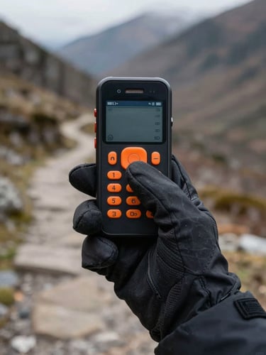
Standard mobile screens fail on the trail. We replaced tiny icons and cluttered menus with ultra-high-contrast layouts designed to be read in direct sunlight and tapped with heavy gloves.

First-person perspective of a hand wearing a thick black winter glove tapping a large, high-contrast orange button on a rugged phone screen, blurry mountain trail background.
Over-the-shoulder shot of a cyclist's handlebar mount holding a phone displaying a simple, ultra-high-contrast black and white topographic map under direct, harsh midday sunlight.
Close-up of a weathered hand holding a rugged smartphone displaying a bright orange screen with oversized white text showing latitude and longitude coordinates, rainy forest background.
UTILITY SUITE

Designed for the trail.

Three essential modifications that turn your standard Android device into a reliable, high-visibility outdoor tool.

TOUCH ACCESSIBILITY

Glove-friendly touch targets

Accidental taps can ruin a route. We expanded the touch target area for every button, allowing precise control even when wearing heavy winter gloves or riding over bumpy singletrack.

SIGNAL INDEPENDENT

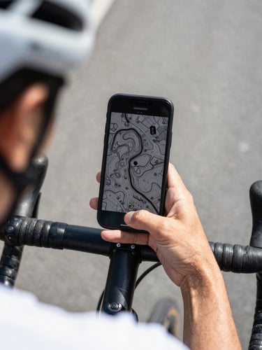
Offline-first navigation tools

Cell towers fade, but your GPS shouldn't. Our core map and compass utilities run entirely offline, caching essential trail data directly to your device storage before you lose coverage.

TRAIL SAFETY

Instant-access emergency SOS

When things go wrong, speed matters. A single, dedicated red button instantly displays your current GPS coordinates in plain text, ready to be sent or read aloud to rescue teams.

+ READY FOR THE TRAIL

Simplify your screen.

Our step-by-step setup guide walks you through installing the launcher and configuring your new high-contrast interface in less than ten minutes.